Cyclone Alfred Delayed: What This Means for Coastal Communities
Cyclone Alfred was meant to hit land earlier, but it has now stopped at sea so that it won’t happen until early Saturday morning. It gives people more time to get ready, but it also makes them more likely to be hurt by strong winds, heavy rain, and big waves.
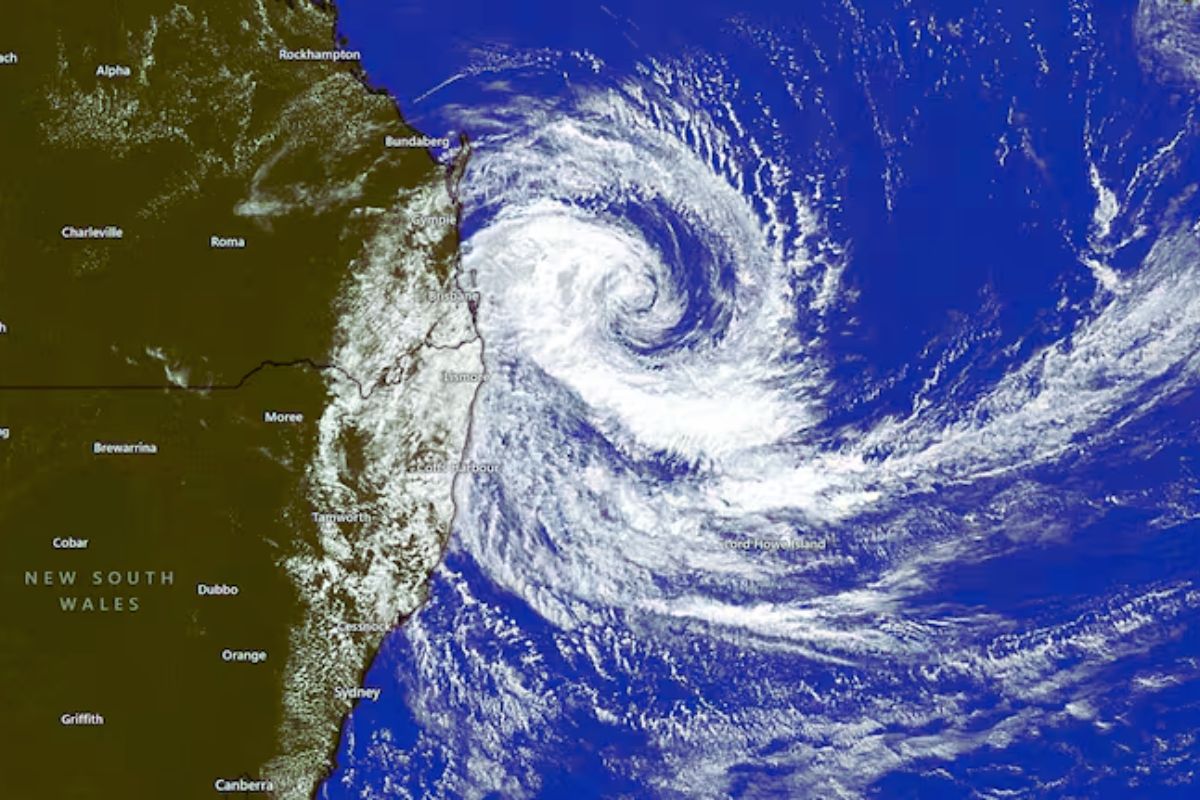
Right now’s location and movement
The most current news says that Cyclone Alfred is about 225 kilometres east-northeast of the Gold Coast, or 245 kilometres offshore from Brisbane. The system’s speed has dropped a lot, and it is now moving westward at about 10 km/h. According to the Bureau of Meteorology (BOM), tropical cyclones are notoriously difficult to track, and Alfred’s erratic movement overnight has led to an adjusted forecast timeline.
Updated Landfall Prediction
BOM meteorologists now expect Alfred to approach the outer islands late Friday before making landfall in the early hours of Saturday, most likely between Noosa and Coolangatta.
Communities along the Queensland coast, including the Gold Coast, Sunshine Coast, and Brisbane’s bayside suburbs, are already experiencing strong winds and large swells. This prolonged exposure to severe conditions raises concerns about potential damage and flooding.
Will Alfred Intensify?
It was first thought that Cyclone Alfred might become a Category 3 storm because it was spending more time offshore, where tropical cyclones get stronger. But the Bureau of Meteorology (BOM) has stated that Alfred will still be a Category 2 storm when it hits land. This category refers to winds that are damaging and can damage buildings, bring down trees, and cause large crop loses.
Storm Surges and High Tide Risks
One big worry is when the land will hit in relation to high tide. Storm waves could make floods and coastal erosion much worse if Cyclone Alfred hits the coast during high tides.
- High tide at 3:42 AM on the Sunshine Coast (Noosa Head) Saturday
- Brisbane Bar: Saturday at 4:45 AM, high tide
- Gold Coast (Snapper Rocks): Saturday at 3:48 AM, high tide
BOM has warned that storm surges could raise sea levels by up to 1.5 metres, mostly along the Gold Coast and in Redlands Bay.
What to Expect When Alfred Hits
Once Alfred makes landfall, it will rapidly weaken as it loses access to warm ocean waters. However, heavy rainfall will remain a significant threat. Parts of northern New South Wales have already received over 200mm of rain in the past 24 hours, and forecasts predict up to 800mm over the event’s duration. This raises concerns about flash flooding and riverine flooding across southeast Queensland and northern New South Wales.
Stay Informed and Prepared
Given the unpredictable nature of cyclones, BOM is constantly monitoring Alfred’s movements and will provide updates as necessary. Residents in impacted regions should stay informed, heed emergency alerts, and take appropriate measures as the hurricane approaches.
This is an ever-changing scenario, so keep an eye out for the most recent information from the BOM and local authorities.


